Maps for makers: Satirical, political and unusual maps
This is the third in a series of blogs dedicated to maps and highlighting Europeana content that can inspire commercial creative reuse by makers.
Maps are historical documents and as such, objective geographical representation isn’t always their main goal. In the past, cartography has been used as a form of political, economical or social propaganda - it served as the medium for spreading cartographers’ biases and believes. In this blog post, we direct our spotlight to maps that made use of satire, symbols and critique to disseminate their messages about the world.
Europa Regina
Map-like depictions of the European continent as a queen were popular in the 1500s. See a beautiful example below from the 18th century. In this map, the author recreated the idea of Europa Regina using Spain as queen’s head, Portugal as her crown and Italy as her left arm.
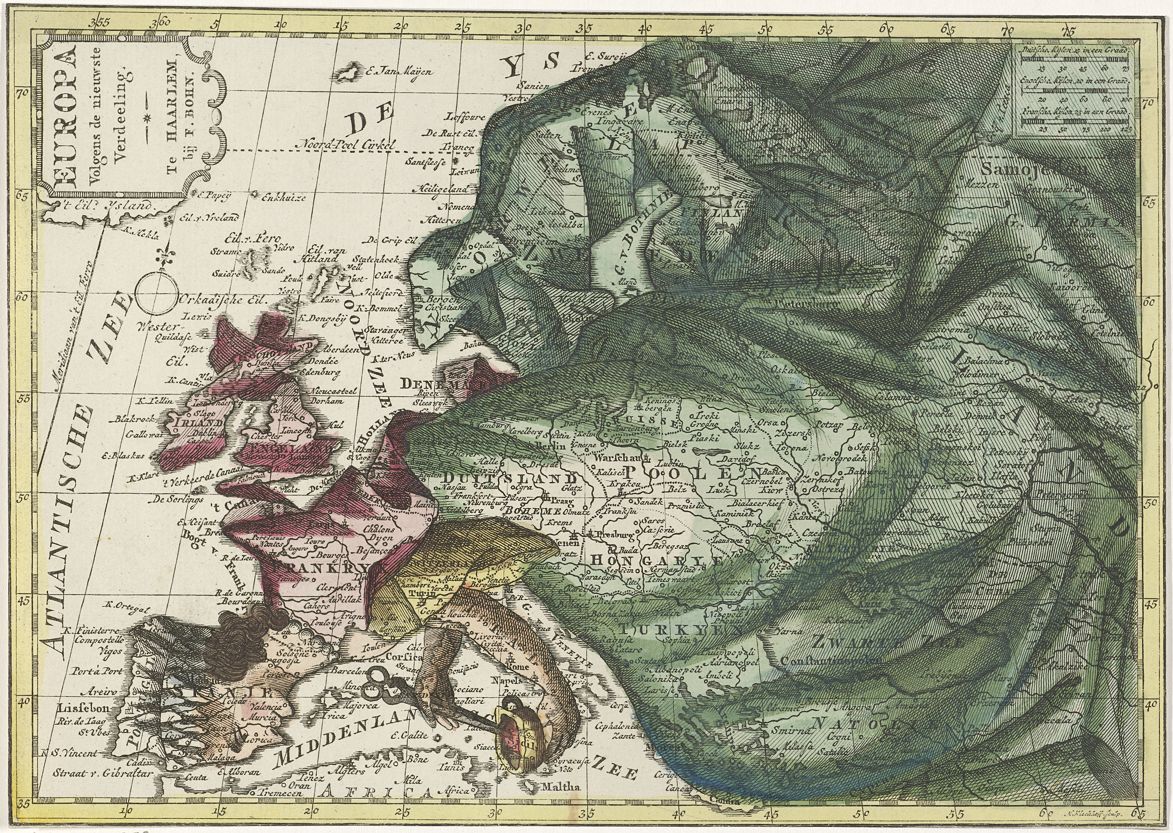
Map of Europe, colored as queen (...). 1788 - 1792. Hendrik Kloekhoff. Rijksmuseum. Public Domain Marked.
Historical battles
The map below shows the Northern Italy and marks the crossing of the Alps by the Prince Eugene of Savoy during the War of the Spanish Succession (1700-1720). Eugene crossed the Alps with some 30,000 men in May/June 1701.
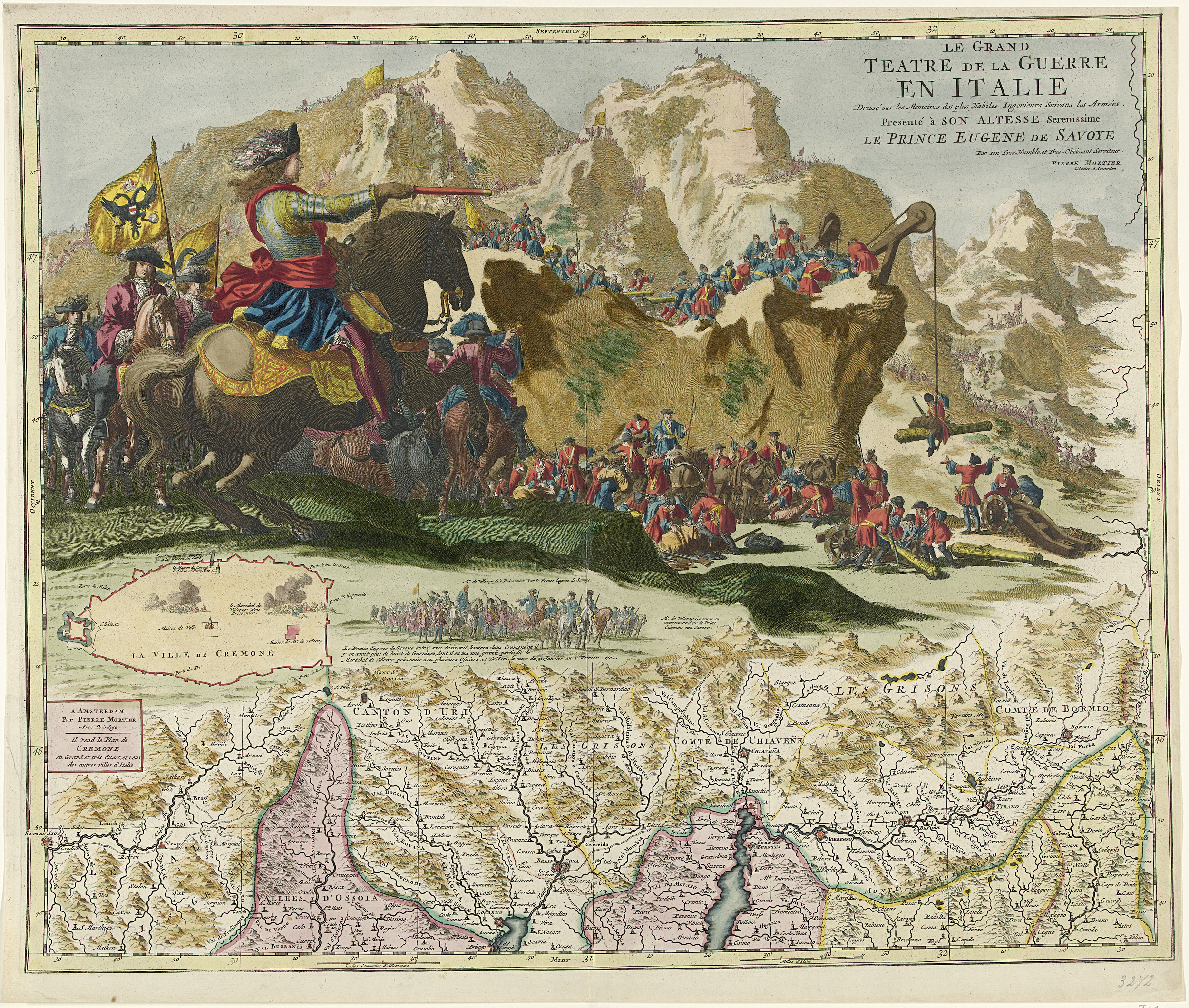
Kaart van Noord-Italië, ca. 1702 and Le Grand Teatre de la Guerre en Italie. Caspar Luyken. Rijksmuseum. Public Domain Marked.
Leo belgicus
The Leo Belgicus (Latin for Belgic Lion) was a map design to symbolize the Low Countries (current day Netherlands, Luxembourg and Belgium) in the shape of a lion, its curved back conforming to the North Sea coastline. The lion symbol was included in the heraldry of most of the Netherlands provinces, representing the struggle for independence of the Seven Northern Provinces against the imperial rule of the Catholic Spanish (Habsburg) Netherlands (1568–1648).

Leo Belgicus. 1967. Johan van Doetechum. VU University Amsterdam Library. CC0
Satirical maps
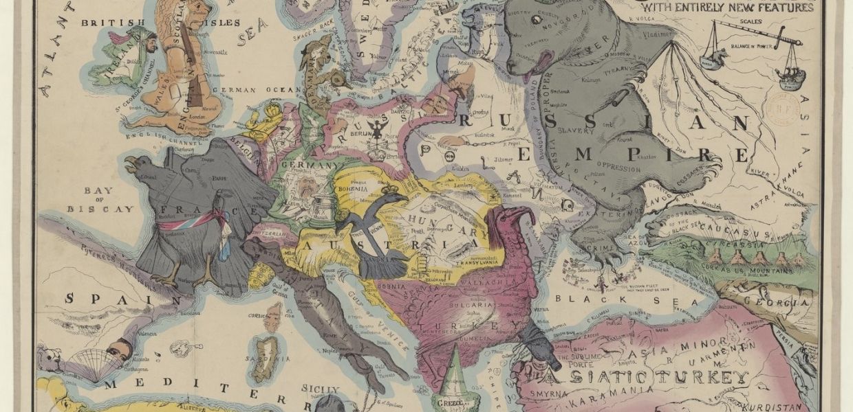
The comic map of the Seat of War (1854) was inspired by the historical events of the Crimean War (1853–1856), in which Britain, France and their allies waged war against Russia. The four principal protagonists are depicted as animals: the British lion; the French imperial eagle; Turkey (the European part) as a turkey; and Russia as a bear.
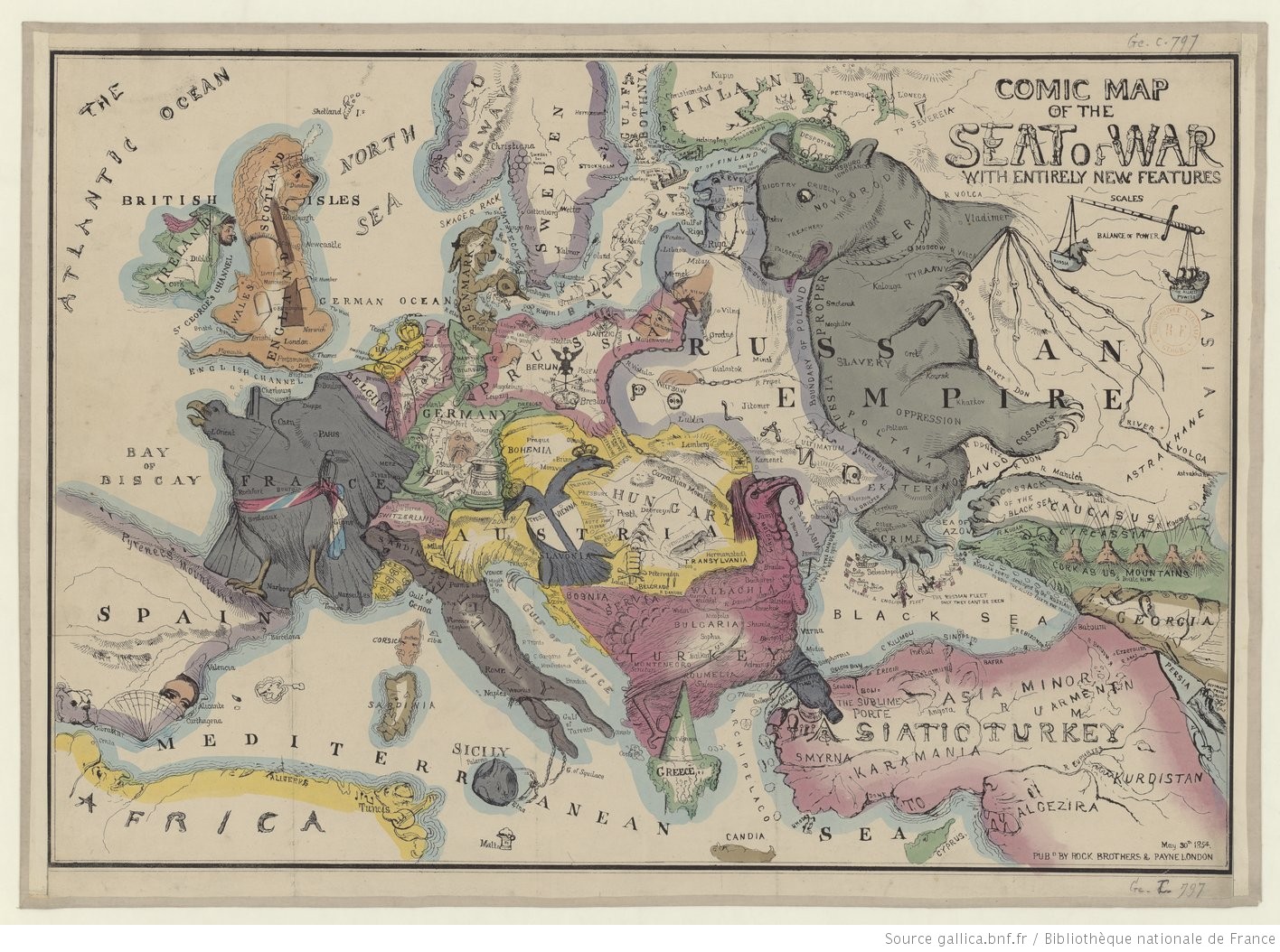
Comic map of the seat of war with entirely new features. 1854. National Library Of France. Public Domain Marked.
A British map of Europe entitled Hark! Hark! The dogs do bark! tells a compelling visual story about First World War early months, in which the key protagonists are represented as dogs.
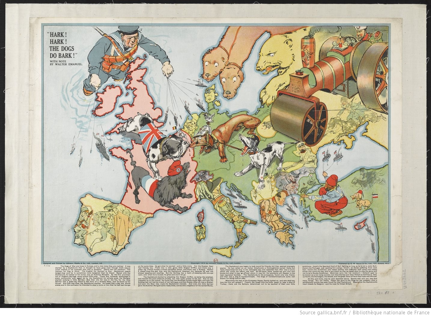
Hark! Hark! The dogs do bark! (...) 1914. National Library Of France. Public Domain Marked.
Follow us on Europeana Labs and on Twitter to find out more interesting maps in the next weeks.
Do you know anyone who uses maps in their creative practice? Do you #MakewithEuropeana? Get in touch via reuse@europeana.eu!