Maps for makers: Famous cartographers
This is the second in a series of blogs dedicated to maps and highlighting Europeana content that can inspire commercial creative reuse by makers.
Maps are formally defined as symbolised representations of known geographical reality. Cartography combines science, art and technology in the map-making process. Despite its accuracy, maps have and continue to distort the presentation of the earth's surface. However, since early times scholars have produced maps in an attempt to refine their technique and guide us in activities such as land surveying, property ownership, and overseas navigation.
In this blog post, we will highlight the work of notable early cartographers. We hope you get inspired by the outputs of these brilliant minds to #MakewithEuropeana.
Buondelmonti
Cristoforo Buondelmonti (1386 - 1430) was an Italian Franciscan priest. He is recognized for his first-hand knowledge of Greece and the historical-geographic work the Liber insularum Archipelagi (1420). Below we feature a miniature of a map of the island of Andros, from this work. Perhaps simplistic to our eyes, in its time it led the innovation of cartography in the sketches and accompanying descriptions, and in these descriptions combining ‘information from the Greek and Latin classics’ with ‘authentic nautical, demographic and political knowledge’. On Europeana you can explore more free to reuse maps by Buondelmonti.

Andros from BL Arundel 93, f. 141. Christoforo Buondelmonti. 1482. The British Library. Public Domain Marked.
Blaeu
Willem Janszoon Blaeu ( 1571 –1638) was a Dutch cartographer, atlas maker and publisher. He was part of the Dutch school of cartography in its Golden Age (16th -17th centuries). Find below two beautiful maps by Blaeu. These historical documents used sailing ships and sea monsters to portray the continents of Asia and America.
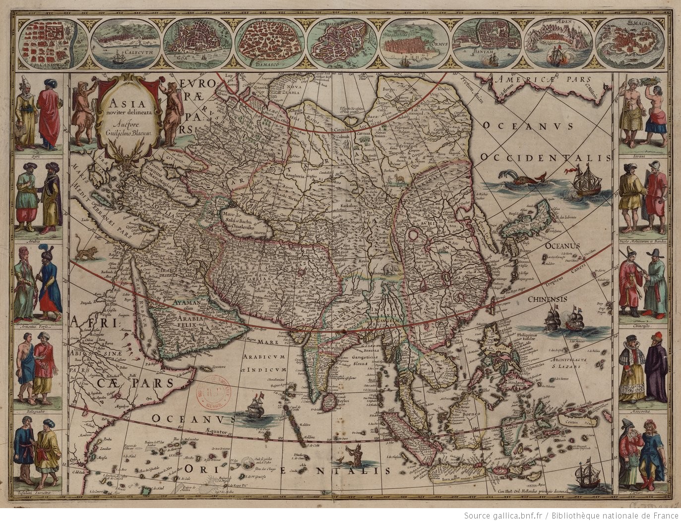
Asia noviter delineata. Willem Janszoon Blaeu. 1630. National Library Of France. Public Domain Marked.
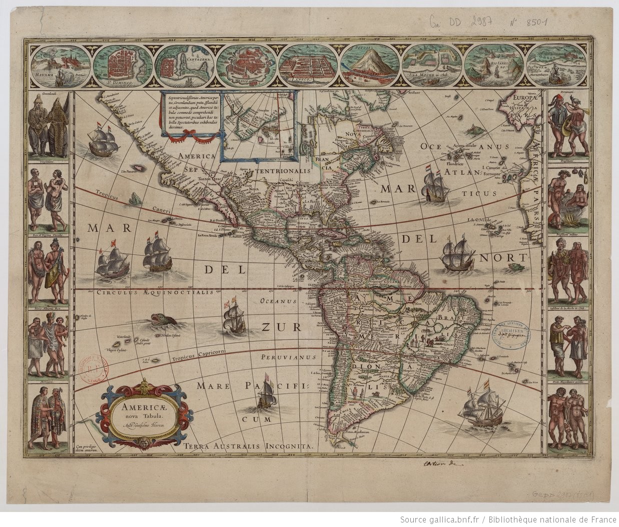
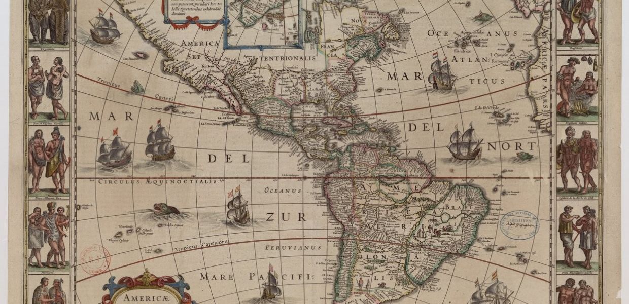
Americae nova tabula. Willem Janszoon Blaeu. 1635. National Library Of France. Public Domain Marked.
Ortelius
Another cartographer that made use of sea monsters to represent nations was Abraham Ortelius (1527 – 1598). He was a Flemish cartographer and geographer, and the creator of the first modern atlas, the Theatrum Orbis Terrarum (Theatre of the World). In this 1587 map of Iceland you can see representations of whales and monstrous sea creatures, white bears (an unfamiliar sight), and volcanic eruptions.
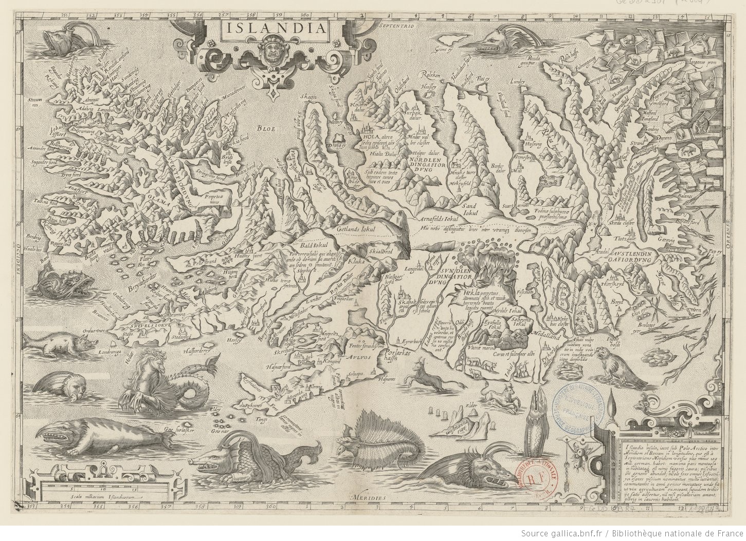
Islandia. Abraham Ortelius. 1587. National Library Of France. Public Domain Marked.
Mercator
Perhaps the most influential of map makers, the Flemish geographer, Gerard Mercator (1512- 1594) is famous for developing a map projection in which mathematical calculations translated the 3D world onto a 2D surface. Discover a map that used Mercator’s projection below.

America sive India nova ad magnae Gerardi Mercatoris avi universalis invitationem... Michael Mercator and Gerard Mercator. 1631. National Library Of France. Public Domain Marked.
Follow us on Europeana Labs and on Twitter to find out more interesting maps in the next weeks.
Do you know anyone who uses maps in their creative practice? Do you #MakewithEuropeana? Get in touch via reuse@europeana.eu!